
Update (About Noon)

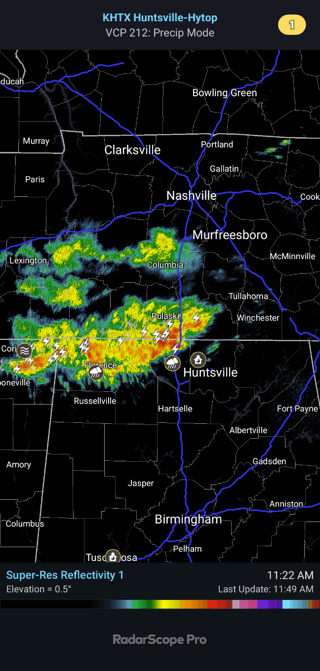
These initial thunderstorms moving through basically the AL/TN state line are not severe at this point, and the main concern is flash flooding for the time being. But as we get into the afternoon, we’ll have to watch for storms trying to reach severe limits. There are no mesoscale discussions or watches in effect at this point, but there may be later.

Well we do have a Flash Flood Watch that clips North Alabama, counties like Blount and Etowah. And there was a report of someone’s basement being flooded back between Corinth and Glen, MS earlier.
Basically it is down to watching radar trends and mesoscale features. We’ll see what this system does. It looks like a messy storm mode today/tonight, and we’ll just have to see how it unfolds before the main squall line gets here. The main threat is damaging winds and maybe some localized flooding issues, but some severe hail is of course possible (probably about quarter-sized), and we do have to be alert for the potential of isolated tornadoes across North Alabama this afternoon/evening. That risk is fairly low, and the wind profiles are certainly not looking ideal for it. But a tornado or two in the region, even within the squall line, definitely not out of the question. This is one of those messy, borderline setups that we just have to watch closely.

12 PM - They just issued a mesoscale discussion, considering a watch, but it’s for way down in West Central Alabama.
For anyone who might miss the vocals I sometimes do on here now that it’s on Substack (and this possible), I’ve had a sore throat recently (mild but definitely there) and some troubling family circumstances (someone in the extended family is about to die and to the best of my knowledge, can no longer talk to or recognize anyone . . . just found out last night), so am saving my voice for something really important if it happens later. And I am temporarily in love with peppermint candy along with my dear tabby cat Stormy, who has been unusually affectionate so far today. I ejected her from my lap and got on the computer after she bit me. Old habits are hard to break . . .
We rescued an orange cat in this neighborhood the other cat. One girl’s tears, afraid she had gotten a cat killed by scaring it up under a car, got the whole block together to rescue the poor little critter, who is being tentatively named Garfield. I tried to coax it out with sardines, which nobody appreciated, especially since it didn’t work. One neighbor bought the kitten some dry food because she said she got tired of us trying to give the cat stinky fish. (Some salmon was offered to the cat after the rescue, which it . . . gender not confirmed yet . . . ate happily.)
Just trying to lighten the mood while we wait on something to happen or not.


12:07 - Here are the latest updated threats from SPC.
While the better threat for tornadoes does look to be around Birmingham and points South, we still have to respect the threat for isolated tornadoes here in North Alabama.
And as far as the damaging thunderstorm wind threat, that does extend North of the Tennessee state line, even if the risk there is considered marginal. And all of us have a marginal risk for severe hail.
Except once you get North of a line from about Waynesboro over to Shelbyville, it looks like the severe stuff will probably leave you alone today, just general rain and thunderstorms up that way.

12:15 - This early-afternoon activity could potentially stabilize the air and mitigate our severe weather threat here in North Alabama. It’s okay to hope for that, but I wouldn’t exactly count on it. I’d be prepared to get to a safe place if severe weather threatens later. These storms right now are not severe though. They may produce locally heavy rainfall, and of course they are putting out a fair amount of lightning. But that’s a lot different than a storm being severe. To be severe, it has to produce winds of at least 50 knots (58 mph) or hail at least the size of a quarter (an inch in diameter). Or of course if a storm produces a tornado, that’s severe . . . none of these storms are showing any signs of anything close to that right now.
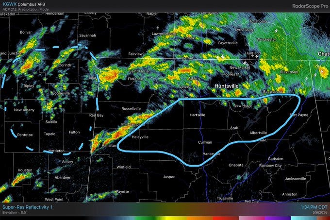
1:42 PM - From NWS Huntsville: The dashed circle in Northern MS, they are watching for new storm development over the next several hours.
The solid circle over much of Northern Alabama (mainly South of the Tennessee River), they are watching for that line of storms currently near Phil Campbell to possibly intensify as the storms get closer to I-65.


2:30 PM - A Tornado Watch has been issued for Central and South Mississippi. It does hug the Alabama state line. But the only thing we’ve got around here right now is a Severe Thunderstorm Warning for Marengo, Hale, Perry, and Dallas counties. That is a supercell thunderstorm well South of our area. Still watching radar trends and local conditions for North Alabama, generally South of the TN River. North of the river, probably not going to have much (if any) trouble with severe weather this afternoon thanks to the rain-cooled air from earlier.