Slight Increase in Rain Chances Tomorrow, More July Heat on the Way Next Week
FORECAST:
Friday (High 89, Low 72): Partly cloudy. Scattered showers and thunderstorms are possible.
Saturday (High 89, Low 71): Partly cloudy. Widely scattered showers and thunderstorms are possible.
Sunday (High 90, Low 70): Mostly sunny. Isolated showers and thunderstorms are possible.
EXTENDED OUTLOOK:
Monday (High 91, Low 71): Partly cloudy with a 30% chance of showers/thunderstorms.
Tuesday (High 92, Low 71): Partly to mostly sunny with a 20% chance of showers/thunderstorms.
Wednesday (High 94, Low 72): Mostly sunny with a 20% chance of showers/thunderstorms.
Thursday (High 95, Low 73): Mostly sunny with a 20% chance of showers/thunderstorms.
READING TEA LEAVES:
Friday July 25 (High 93, Low 73): Partly cloudy with a 30% chance of showers/thunderstorms.
Saturday July 26 (High 92, Low 73): Partly cloudy with a 30% chance of showers/thunderstorms.
Sunday July 27 (High 92, Low 72): Partly cloudy with a 30% chance of showers/thunderstorms.
BEACH FORECAST:
Friday (High 89, Low 77): Showers and thunderstorms likely. Dangerous rip currents.
Saturday (High 91, Low 78): Mostly cloudy with numerous showers and thunderstorms possible. Hazardous rip currents are still possible.
Sunday (High 92, Low 77): Partly cloudy. Widely scattered showers and thunderstorms are possible.
PRONÓSTICO:
Viernes (Máxima: 89, Mínima: 72): Parcialmente nublado. Posibles lluvias y tormentas eléctricas dispersas.
Sábado (Máxima: 89, Mínima: 71): Parcialmente nublado. Posibles lluvias y tormentas eléctricas muy dispersas.
Domingo (Máxima: 90, Mínima: 70): Mayormente soleado. Posibles lluvias y tormentas eléctricas aisladas.
PRONÓSTICO EXTENDIDO:
Lunes (Máxima: 91, Mínima: 71): Parcialmente nublado con un 30 % de probabilidad de lluvias/tormentas eléctricas.
Martes (Máxima: 92, Mínima: 71): Parcialmente a mayormente soleado con un 20 % de probabilidad de lluvias/tormentas eléctricas.
Miércoles (Máxima: 94, Mínima: 72): Mayormente soleado con un 20 % de probabilidad de lluvias/tormentas eléctricas.
Jueves (Máxima: 95, Mínima: 73): Mayormente soleado con un 20 % de probabilidad de lluvias y tormentas eléctricas.
LEYENDO LAS HOJAS DE TÉ:
Viernes 25 de Julio (Máxima 93, Mínima 73): Parcialmente nublado con un 30 % de probabilidad de lluvias y tormentas eléctricas.
Sábado 26 de Julio (Máxima 92, Mínima 73): Parcialmente nublado con un 30 % de probabilidad de lluvias y tormentas eléctricas.
Domingo 27 de Julio (Máxima 92, Mínima 72): Parcialmente nublado con un 30 % de probabilidad de lluvias y tormentas eléctricas.
PRONÓSTICO DE LA PLAYA:
Viernes (Máxima 89, Mínima 77): Probabilidad de lluvias y tormentas eléctricas. Corrientes de resaca peligrosas.
Sábado (Máxima 91, Mínima 78): Mayormente nublado con posibilidad de numerosas lluvias y tormentas eléctricas. Corrientes de resaca peligrosas.
Domingo (Máxima 92, Mínima 77): Parcialmente nublado. Posibles lluvias y tormentas eléctricas dispersas.
NOTES:
If you’re headed to the beach, here is some information on rip current safety.
NOAA has an animated series (also known as a cartoon) to teach kids about weather and climate.
Weatherbrains did a great show recently about the flooding tragedy in Texas, which has claimed well over 100 lives with many people still missing.
Saturday will be the anniversary of Hurricane Danny from 1997.
On that note, while the tropics are quiet is the best time to make sure your hurricane safety plan is ready to go, if you live along or near the coast.
DISCUSSION:
We had a partly cloudy day in Cullman with a period of light rain in the afternoon. The High was 90, and the Low was 73. Jasper saw a High of 91 and Low of 72. Haleyville saw a High of 90 and a Low of 72. Huntsville had a High of 93 and Low of 76 today. And Nashville saw a High of 94 and Low of 77.
The humidity made it feel like over 100 degrees at times. But the heat advisory expires this evening.

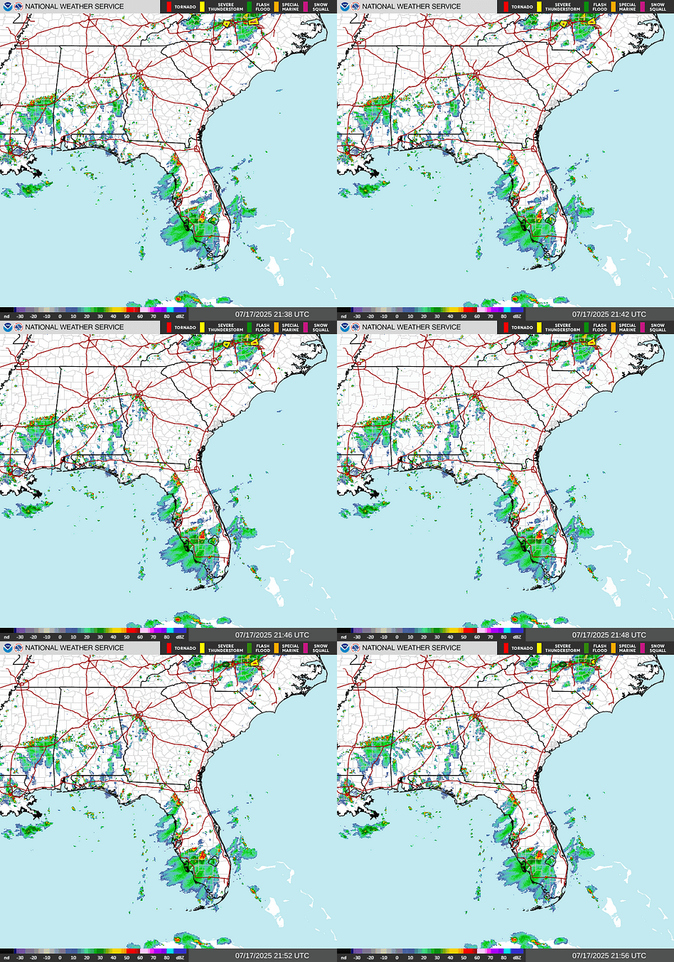
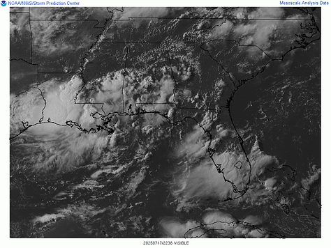
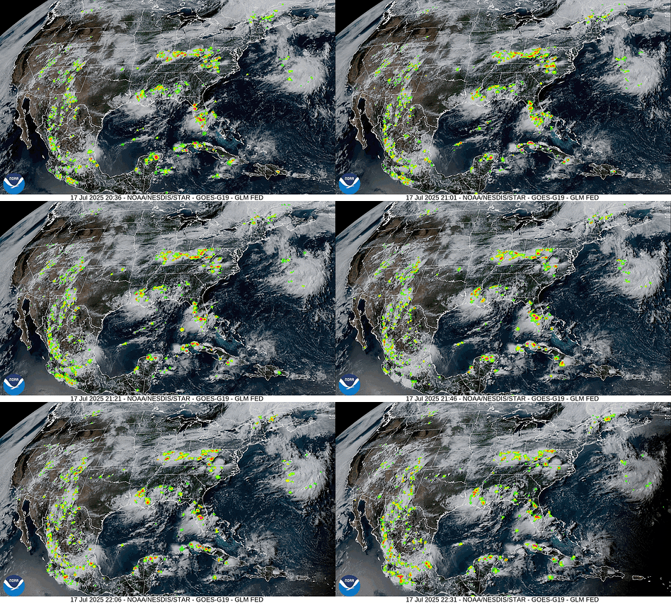
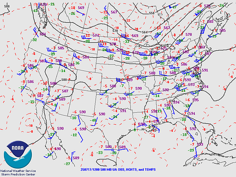
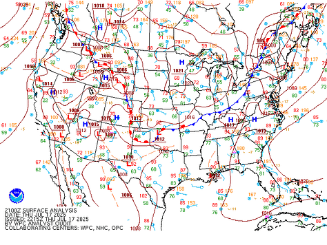
We’ve got that weak ridging well to our North and surface High pressure in our region, also a front draped through New England, the Ohio Valley, the Midwest, the Plains, all the way back up through the Rockies and up into the Pacific Northwest. Our only local source of any significant moisture right now is that Low pressure system riding the Louisiana coast.
So let’s take a look at that source of much unmerited hype.
Keep reading with a 7-day free trial
Subscribe to That Weather Blog to keep reading this post and get 7 days of free access to the full post archives.


