Significant Heat/Humidity Possible Next Week
FORECAST:
Friday (High 89, Low 72): Partly cloudy, seasonably hot and humid. Widely scattered showers and thunderstorms are possible.
Saturday (High 92, Low 71): Mostly sunny, hot and humid. Isolated showers and thunderstorms are possible.
Sunday (High 94, Low 72): Mostly sunny. Very hot and humid.
EXTENDED OUTLOOK:
Monday (High 95, Low 73): Mostly sunny.
Tuesday (High 97, Low 75): Mostly sunny.
Wednesday (High 96, Low 75): Partly cloudy with a 20% chance of showers/thunderstorms.
Thursday (High 94, Low 74): Partly cloudy with a 20% chance of showers/thunderstorms.
READING TEA LEAVES:
Friday August 1 (High 92, Low 73): Partly cloudy with a 30% chance of showers/thunderstorms.
Saturday August 2 (High 90, Low 72): Partly cloudy with a 40% chance of showers/thunderstorms.
Sunday August 3 (High 89, Low 70): Partly cloudy with a 30% chance of showers/thunderstorms.
BEACH FORECAST:
Friday (High 89, Low 77): Mostly cloudy with numerous showers and thunderstorms possible. Dangerous rip currents.
Saturday (High 91, Low 77): Partly to mostly cloudy. Scattered showers and thunderstorms are possible.
Sunday (High 93, Low 76): Mostly sunny.
Rest of Week (Highs in 90’s, Lows in 70’s): Partly cloudy with a 30% chance of showers/thunderstorms.
PRONÓSTICO:
Viernes (Máxima: 89, Mínima: 72): Parcialmente nublado, con un clima cálido y húmedo típico de la temporada. Posibles lluvias y tormentas eléctricas muy dispersas.
Sábado (Máxima: 92, Mínima: 71): Mayormente soleado, con un clima cálido y húmedo. Posibles lluvias y tormentas eléctricas aisladas.
Domingo (Máxima: 94, Mínima: 72): Mayormente soleado. Muy caluroso y húmedo.
PRONÓSTICO EXTENDIDO:
Lunes (Máxima: 95, Mínima: 73): Mayormente soleado.
Martes (Máxima: 97, Mínima: 75): Mayormente soleado.
Miércoles (Máxima: 96, Mínima: 75): Parcialmente nublado con un 20 % de probabilidad de lluvias/tormentas eléctricas.
Jueves (Máxima: 94, Mínima: 74): Parcialmente nublado con un 20 % de probabilidad de lluvias/tormentas eléctricas.
LEYENDO LAS HOJAS DE TÉ:
Viernes 1 de agosto (Máxima 92, Mínima 73): Parcialmente nublado con un 30 % de probabilidad de lluvias o tormentas eléctricas.
Sábado 2 de agosto (Máxima 90, Mínima 72): Parcialmente nublado con un 40 % de probabilidad de lluvias o tormentas eléctricas.
Domingo 3 de agosto (Máxima: 89, Mínima: 70): Parcialmente nublado con un 30 % de probabilidad de lluvias o tormentas eléctricas.
PRONÓSTICO DE LA PLAYA:
Viernes (Máxima 89, Mínima 77): Mayormente nublado con posibilidad de numerosos chubascos y tormentas eléctricas. Corrientes de resaca peligrosas.
Sábado (Máxima 91, Mínima 77): Parcialmente nublado. Posibles chubascos y tormentas eléctricas dispersas.
Domingo (Máxima 93, Mínima 76): Mayormente soleado.
Resto de la Semana (Máximas en los 90 grados, Mínimas en los 70 grados): Parcialmente nublado con un 30 % de probabilidad de lluvias y tormentas eléctricas.
NOTES:
A lot of it may be common sense, but it’s still a good time to brush up on heat safety.
It is with some sadness that I pass along the report that a boy died in Bessemer this week from being left in a hot car.
If you’re headed to the beach, here is information on how to stay safe in rip currents, should you encounter one.
Wes Wyatt has a book out called Bread, Milk, and a Chance of Snow. And he recently talked to AL.com about it.
There sure have been a lot of celebrity deaths lately - Malcolm Jamal-Warner from the Cosby Show, Ozzy Osbourne who knew how to rock out even when confined to a chair in his last days, and now Hulk Hogan. Somebody needs to tell the Grim Reaper to take it easy, he’s earned his overtime. I was lucky enough to see the Hulkster beat the bejesus out of Chris Jericho one time, even though Jericho used a chair on him. The only time I got to see a live wrestling show, but it sure was a good one.
Anyway, once again I’ll say that I strongly encourage everyone to take the heat hazard seriously next week. Even if people don’t always get a full-blown heatstroke and die, they can get really sick. Heat is actually our #1 weather killer, ahead of floods, lightning, and tornadoes. And obviously it’s because people don’t pay as much attention to it. We’ve got a lot of homeless people around these parts too, and hey, some of them have cell phones. So hey, I’m talking to you too. Be smart next week about where you go, what time of the day. And don’t waste all your money on Cokes. Drink some real water too. Free advice, take it or leave it. A cool guy I knew who was homeless for a long time recently found a place. So there is good news out there too. You just have to look for it sometimes.
DISCUSSION:
At 1 PM skies are partly cloudy in Cullman. The temperature is 88 degrees. The dewpoint is 73 degrees, making the relative humidity 62% and the heat index 96 degrees. Winds are variable at 5 miles per hour, with gusts to 12 mph. The pressure is 30.17 inches and steady. The Low this morning only got down to 75.
Skies are fair in Jasper with a temperature of 90 degrees and a dewpoint of 75, making the relative humidity 63% and the heat index 100. Winds are variable at 5 mph, gusting to 14 mph. The pressure is 30.14 inches and steady. The Low this morning was 73.
It looks like I may have used slightly old observations for Jasper, like by 30 minutes or so, because I forgot to hit the refresh button. But I’m moving along to Haleyville anyway.
Haleyville is mostly cloudy and 88 degrees with a dewpoint of 75, making the relative humidity 66% and the heat index 98 degrees. Winds are from the East at 6 mph. The pressure is 30.17 inches/997.3 millibars and steady. They had a Low of 72 this morning.
It is mostly sunny and 91 in Decatur, bit of a breeze there. Mostly sunny and breezy in Huntsville with a temperature of 89. Mostly sunny and 93 in Muscle Shoals.
Mostly cloudy and 89 in Tupelo. Mostly cloudy and 90 in Memphis. Partly cloudy and 91 in Nashville. The heat index in Nashville is already to 95. We’re all pretty hot, as we should be in late July around here.
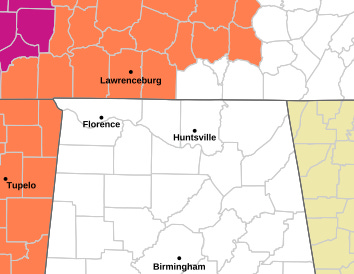
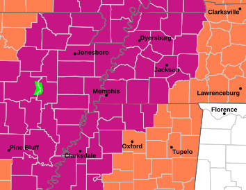
We have a Heat Advisory that includes counties like Giles, Lawrence, Wayne, and Hardin in Tennessee. But then as you get back toward Memphis and into parts of Mississippi and Arkansas, they have an Extreme Heat Warning, where the combination of heat and humidity could be particularly hazardous to people not taking reasonable precautions, or who don’t have a reasonable way to get out of the heat or stay cool enough.
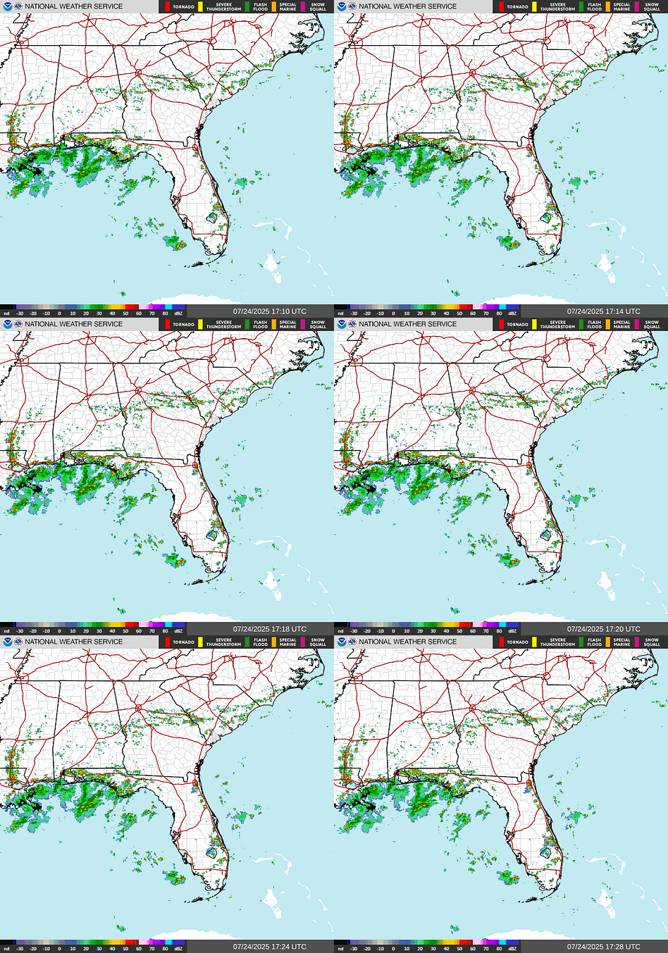
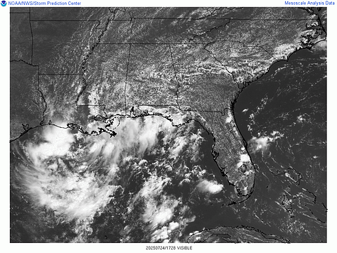
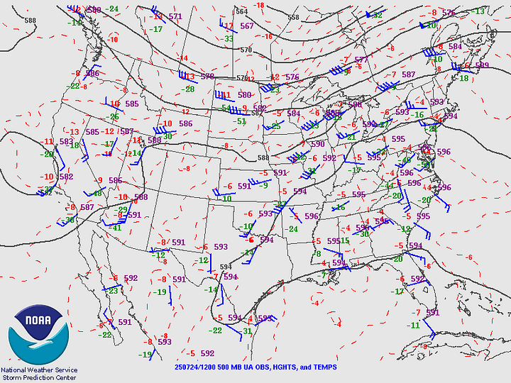
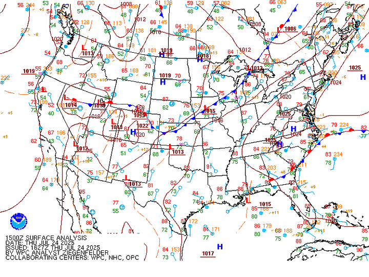
We are going to stay under a ridge in the upper levels with high pressure down at the surface. And we are going to stay hot through next week. The worst heat is probably yet to come.
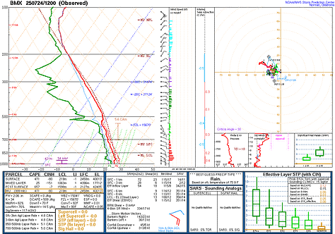
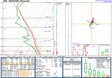
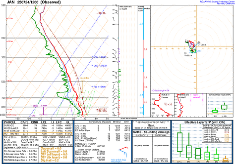
Upper-air soundings from Birmingham, Nashville, and Jackson (MS) this morning all show about what you’d expect in this pattern.
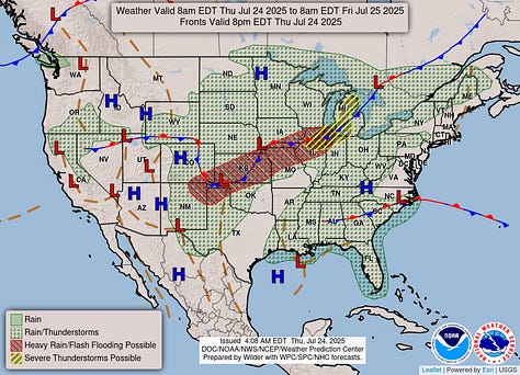
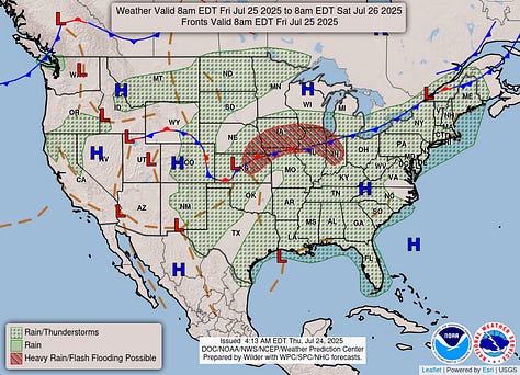
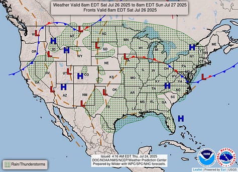
Now from the Plains up into the Midwest, they have some risk of flash flooding along a front that’s pretty much stalled for the moment. And as you get up more toward the Great Lakes, some places could even see some severe thunderstorms. But around here, rain will be scarce, and the only real story is the heat.
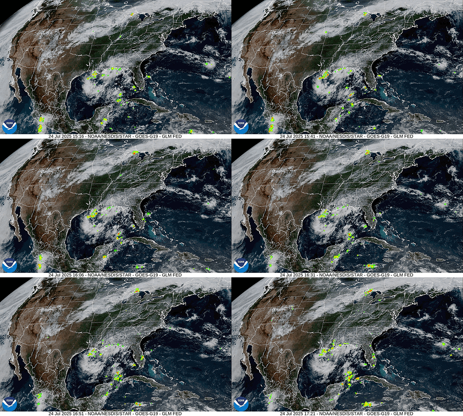
If you’ve heard any buzz about this broad area of Low pressure over the North-Central Gulf, it’s no big deal. It is drifting Westward, but other than producing some periods of locally heavy rainfall along the coast there, I don’t think it’s going to do anything. The National Hurricane Center gives it only a 10% chance of developing into a tropical cyclone, even over the next seven days. And I personally think it’s a nothingburger.
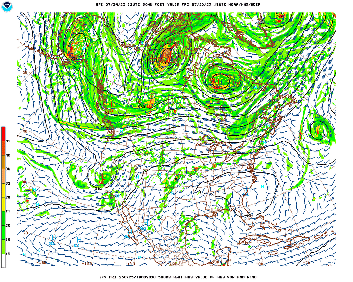
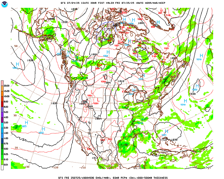
Looks like tomorrow the high pressure will relax enough to bring us a slightly higher chance of showers or thunderstorms, which is still not much, about 30%. Look for a High of about 89-90, a Low near 72.
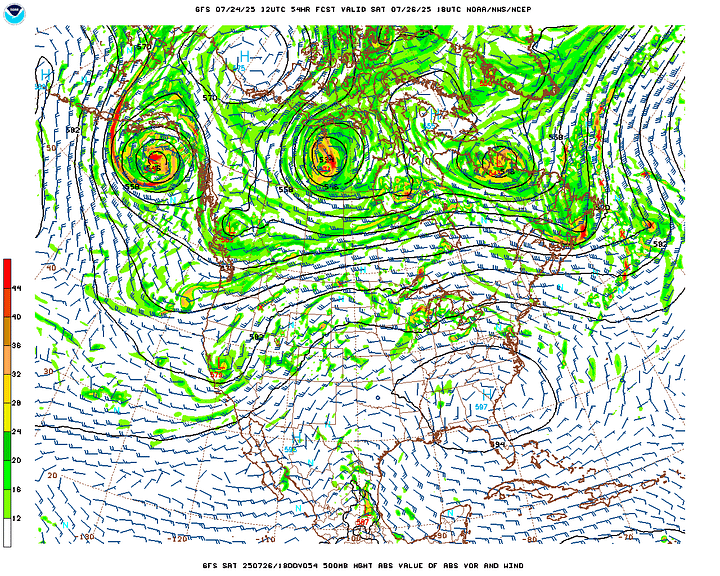
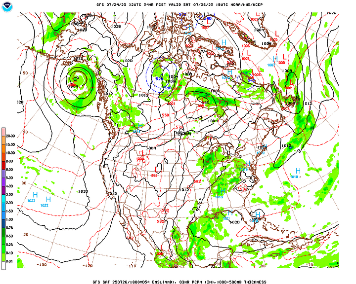
The high pressure will start to build back in more strongly on Saturday, and a lot of times you may hear a feature like you see on the 500 millibar maps from the GFS here (the one on the left with all the contours and wind barbs) called a “heat bubble”. And that’s apt. Looks like only a 20% chance of rain again and a High in the 90-92 range, Low in the 70-72 range.
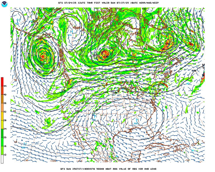
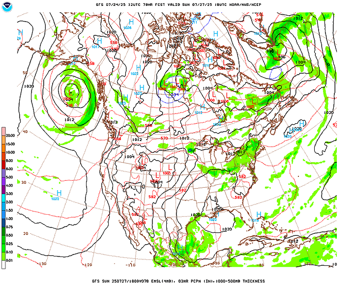
That trend will continue on Sunday. Highs should still be in the lower 90’s and Lows in the lower 70’s, but we’ll have to watch the humidity combining with that. Rain chance should be about 10-20%, may leave it out of the official forecast up top.
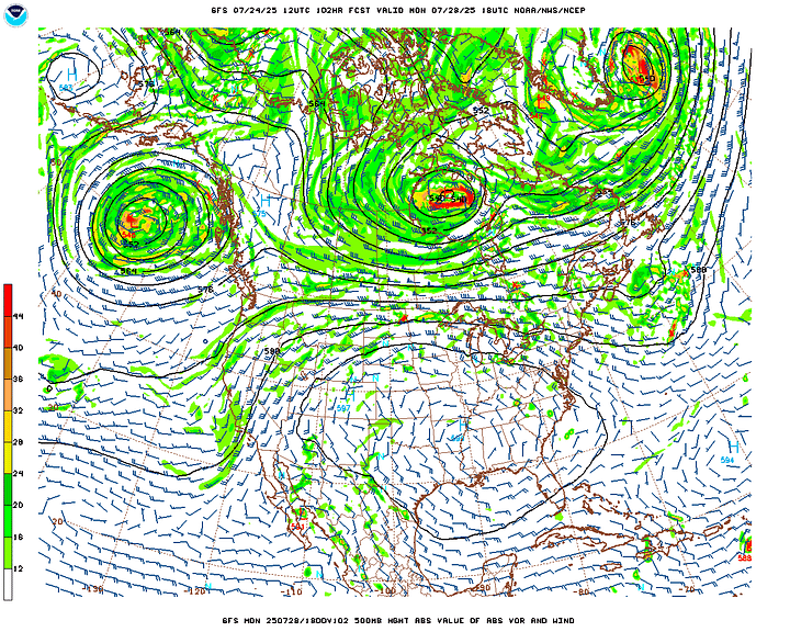
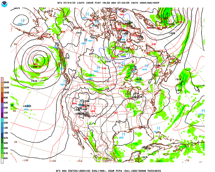
Monday looks much the same, almost no chance of rain, and just hot and muggy. It is likely we’ll be back under a Heat Advisory (as in all of us, North Alabama and Southern Middle Tennessee), and it wouldn’t be out of the question for some of our counties to see an Extreme Heat Warning like they have had back toward Memphis lately, which is issued when Heat Indices exceed 110 degrees. Remember that the heat index is a lot like wind chill; it’s not just what it feels like, but people’s bodies can be affected as if that is the actual temperature. That’s why it’s important to pay attention to when we get that combination of too much humidity with the heat this time of year.
Actual temperatures Monday expected to be in the lower-to-mid-90’s with Lows in the lower-to-mid-70’s.
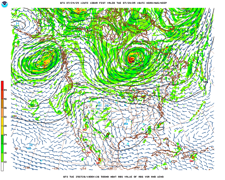
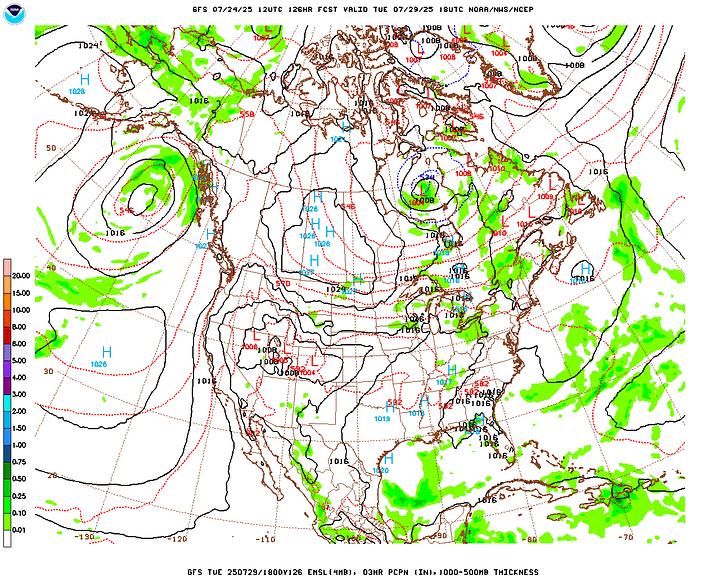
I think mid-90’s will be common by Tuesday, with some places perhaps reaching the upper 90’s. Almost no chance of rain, although any summer day, you can technically get a shower or thunderstorm. In this kind of weather, you’re really lucky if you do. Even a hailstorm might be a welcome relief to some people with this kind of heat and humidity that’s likely to accompany it. This is starting to look rough.
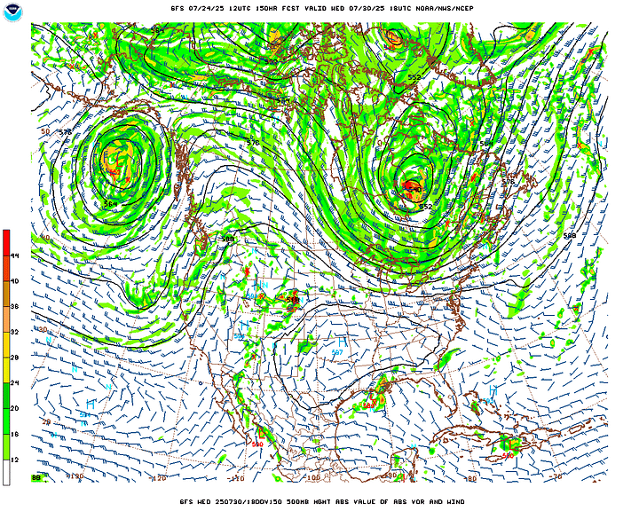
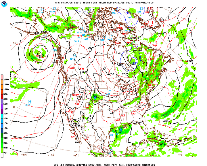
Looks like fairly similar weather for Wednesday . . .
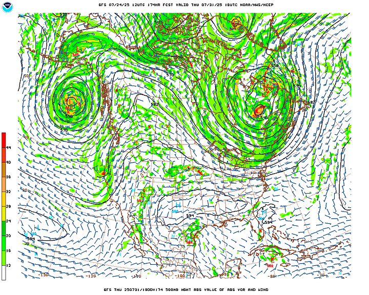
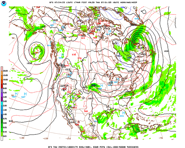
Actually with the computer model trends, it’s a close call, but it looks like the heat bubble may relax slightly Wednesday and Thursday. We can bring a 20% chance of rain back and maybe “cool” things off a degree or two. But look, this is some serious heat regardless of how it varies from day to day. This could get downright dangerous for some people, like people who have to work outside. And I hope employers will make reasonable allowances for stuff like that. What we’ve got coming up is not your usual summer heat and humidity. Next week looks potentially dangerous in that way. It doesn’t look like the worst heat wave we’ve ever had, or anything like that, but it’s one of those time periods to be careful and check up on loved ones (including pets), sort of like when we have that pipe-busting weather in the wintertime.
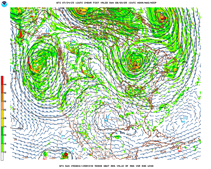
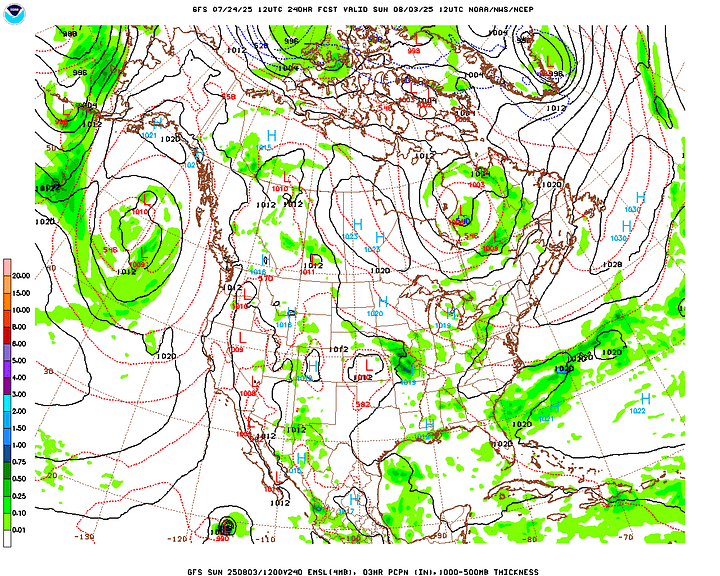
If you look out to 10 days, that will actually take us into the beginning of August, and while you have to take model guidance like this with a grain of salt, it does show temperatures moderating back to seasonal norms. As the high pressure relaxes and we get about a 30% chance of rain again.
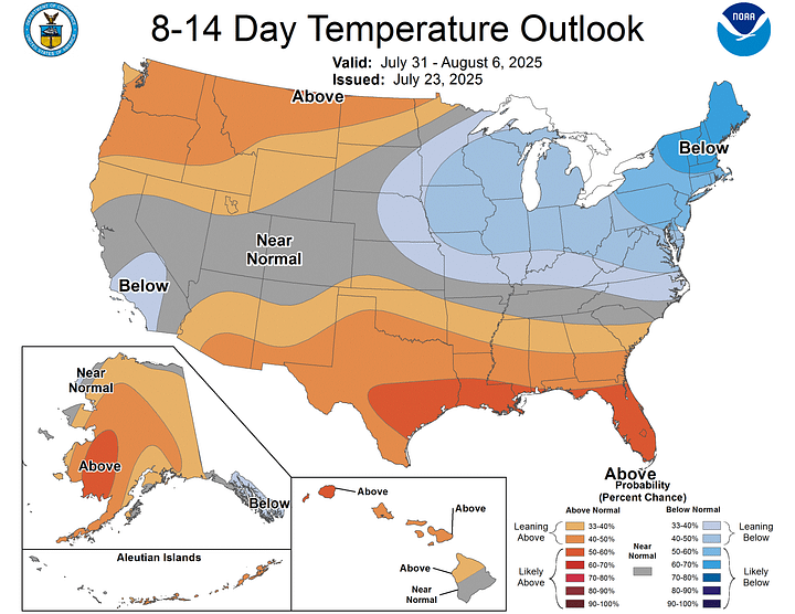
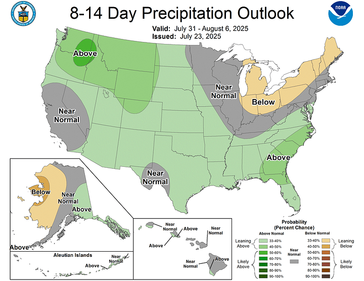
The Climate Prediction Center predicts temperatures slightly below average in the 8-14 day range. And our rainfall amounts are expected to be about average.
But for about the next week, rain is going to be spotty, except down along the Gulf Coast and far Southern Alabama and Mississippi, Florida, Louisiana, places like that. And I would advise a reasonable level of caution with this kind of heat and humidity. Also remember that some folks, like kids and older people, can be more susceptible to heat exhaustion or heatstroke. And so can people with certain medical conditions. So can pets if they’re left out too long.
I hope my readers wouldn’t do this anyway, but please never leave somebody in a hot car. We just had a poor kid die in Bessemer from a situation like that, and there is really no need to let such things happen. It’s depressing to see it every year, wherever it happens. With that thing in Texas where a bunch of people died from a historic flood recently, I’m not looking to blame anyone. What I care about is that they continue to find everybody and assess what happened, and how we can do better next time something like that comes along. A death toll well over 100 is unacceptable; no meteorologist or public safety official wants to see that. But sometimes things catch people off guard, and there’s not a whole lot we can do besides assess what went wrong and like I say, try to do better in the future, learn from it. When it comes to this business of leaving someone in a hot car, everybody knows that is a really bad idea. Sometimes they get careless and do it anyway. But please, none of that, let’s take care of each other the same as we would in the winter months when it’s “colder than a well-digger’s ass”, as my grandpa would have put it. He sure could have a way with words. I believe his phrase for next week’s weather was more along the lines of, “It’s hotter ‘n forty hells out ‘ere!”
But seriously, stay cool.


