


4th of July Weekend Forecast
Looking like mostly clear skies and seasonable heat with lower humidity than the seasonal average . . .

FORECAST:
Independence Day (High 91, Low 67): Sunny. Seasonably hot.
Saturday (High 93, Low 69): Mostly sunny. Seasonably hot.
Sunday (High 92, Low 70): Mostly sunny. Rain chances staying minimal.
EXTENDED OUTLOOK:
Monday (High 91, Low 70): Partly cloudy with a 20% chance of showers/thunderstorms.
Tuesday (High 91, Low 71): Partly cloudy with a 30% chance of showers/thunderstorms.
Wednesday (High 88, Low 72): Partly to mostly cloudy with a 40% chance of showers/thunderstorms.
Thursday (High 89, Low 71): Partly cloudy with a 30% chance of showers/thunderstorms.
READING TEA LEAVES:
Friday July 11 (High 90, Low 70): Partly cloudy with a 20% chance of showers/thunderstorms.
Saturday July 12 (High 89, Low 70): Partly cloudy with a 30% chance of showers/thunderstorms.
Sunday July 13 (High 90, Low 71): Partly cloudy with a 20% chance of showers/thunderstorms.
BEACH FORECAST:
Independence Day (High 92, Low 73): Mostly sunny.
Saturday (High 92, Low 75): Partly cloudy with a 40% chance of scattered showers/thunderstorms.
Sunday (High 90, Low 73): Mostly cloudy with a 50% chance of numerous showers/thunderstorms.
Next Week (Highs ~90, Lows ~75): Partly cloudy with a 40% chance of scattered showers/thunderstorms.
PRONÓSTICO:
Día de la Independencia (Máxima 91, Mínima 67): Soleado. Calor propio de la temporada.
Sábado (Máxima 93, Mínima 69): Mayormente soleado. Calor propio de la temporada.
Domingo (Máxima 92, Mínima 70): Mayormente soleado. Probabilidad mínima de lluvias.
PRONÓSTICO EXTENDIDO:
Lunes (Máxima 91, Mínima 70): Parcialmente nublado con un 20 % de probabilidad de lluvias/tormentas.
Martes (Máxima 91, Mínima 71): Parcialmente nublado con un 30 % de probabilidad de lluvias/tormentas.
Miércoles (Máxima 88, Mínima 72): Parcialmente nublado con un 40 % de probabilidad de lluvias/tormentas.
Jueves (Máxima 89, Mínima 71): Parcialmente nublado con un 30 % de probabilidad de lluvias/tormentas.
LEYENDO LAS HOJAS DE TÉ:
Viernes 11 de Julio (Máxima 90, Mínima 70): Parcialmente nublado con un 20 % de probabilidad de lluvias/tormentas.
Sábado 12 de Julio (Máxima 89, Mínima 70): Parcialmente nublado con un 30 % de probabilidad de lluvias/tormentas.
Domingo 13 de Julio (Máxima 90, Mínima 71): Parcialmente nublado con un 20 % de probabilidad de lluvias/tormentas.
PRONÓSTICO DE LA PLAYA:
Día de la Independencia (Máxima 92, Mínima 73): Mayormente soleado.
Sábado (Máxima 92, Mínima 75): Parcialmente nublado con un 40 % de probabilidad de lluvias/tormentas dispersas.
Domingo (Máxima 90, Mínima 73): Mayormente nublado con un 50 % de probabilidad de numerosas lluvias/tormentas.
Próxima Semana (Máximas ~90, Mínimas ~75): Parcialmente nublado con un 40 % de probabilidad de lluvias/tormentas dispersas.
NOTES:
Here are some reminders about how to stay safe in rip currents.
The Weatherbrains podcast recently interviewed Max Velocity.
Gary England passed away recently as well. As did Bill Moyers outside the world of weather.
Some of our neighbors to the North got a light show last night thanks to a solar storm. Here is a handy reference for when the aurora borealis will be visible from where.
If you have any feedback on my attempts at Spanish forecasts, feel free to send me an e-mail or leave a comment.
DISCUSSION:
At 12:15 PM CDT, skies are sunny in Cullman. The temperature is 82 degrees. The dewpoint is 70 degrees, making the relative humidity 66%. Winds are from the North at 5 miles per hour. The pressure is 30.06 inches and falling slowly. The Low temperature this morning was 66. And we did have a little bit of patchy fog early this morning.
It is mostly cloudy and 86 in Jasper at this hour. The dewpoint is 70, making the relative humidity 59%. Winds are calm. The pressure is 30.05 inches and falling. The Low temperature this morning was 66. And they had a bit more fog this morning than Cullman.
It is mostly sunny and 85 degrees in Decatur. The dewpoint is 68, making the relative humidity 57%. Winds are North at 7 mph. The pressure is 30.05 inches/1016.7 millibars and steady. The Low temperature this morning was 69. And they too had some patchy fog around daybreak. I'm using their observations instead of Haleyville's since Haleyville's observations have been unavailable for about the past week or so.
Elsewhere around the area, Huntsville is mostly cloudy and 87 degrees. Muscle Shoals is sunny and 87. Tupelo is sunny and 84. Memphis is partly cloudy and 84. Nashville is mostly cloudy and 87.


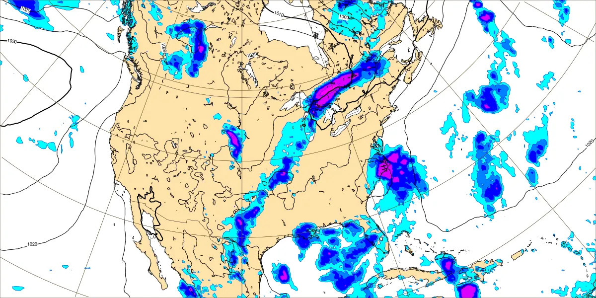
The front is moving through the Mid-Atlantic coast now, and we have some unusually dry air for the first few days of July. Our upper-level wind flow is currently from the Northwest. Surface high pressure is in place over the Mid-South, the Ohio Valley, and the Virginias, also down in the Gulf. Most of the rain associated with that front is offshore in the Atlantic or even down over the Florida Peninsula.

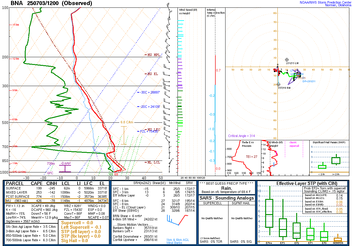

This morning’s radiosonde data (from 12Z/7 AM CDT) shows less humidity than we usually have this time of year. It’s still hot out there, I can personally attest from taking a walk earlier this morning, but it’s not as muggy as it usually is in early July. You can tell the difference whenever the breeze kicks up.
It’ll probably only get up to about 87 or 88 degrees this afternoon. Skies staying mostly sunny.


Tomorrow we will be firmly under a ridge of high pressure and staying sunny. Look for a High of about 91-92, a Low of about 66-67.
Holiday celebrations should be fine.


Saturday also looks dry, High of about 92-93, Low rebounding to about 69-70. They’ll have to watch around the Florida Bend/Peninsula, near there, for rain caused by the remnants of the front.


On Sunday we probably stay dry too, but the GFS is starting to show some Gulf moisture getting going at least down around the coast.
The ECMWF is on board with this. So it’s something to watch.
Rain chances are going to be minimal on Sunday, but reintroducing a 20% chance might be reasonable. Again looking for a High of about 92 and Low near 70.


Monday bringing back the standard 20% summer chance of rain definitely looks reasonable. High should be about 90 or so, Low near 70.


Tuesday looks like a mix of sun and clouds, rain chances more like 30% which is still in that lower range like you’d expect this time of year. Look for a High of 90 or so, Low near 70.


By Wednesday it looks like a weak frontal boundary will be moving through. Will increase rain chance to 40% to account for this. But even with this recent front, the rain was not as widespread as models suggested it would be. Look for a High in the upper 80’s and a Low of 70 or so.


For Thursday, trimming rain chances back to 30% looks reasonable. High should be in the upper 80’s, Low near 70.


Then looking into the land of tea leaves, next weekend, it looks like a 20-30% chance of rain and Highs near 90, at least upper 80’s, and Lows near 70.


The tropics are worth watching with the remnants of this cold front that is bringing us the lower humidity for now. A subtropical or tropical low may gradually develop this weekend and beyond, and then we’ll see who it brings the most rain to. Right not it’s looking like the East Coast of Florida, Georgia, and maybe the Carolinas would be the most likely spots, more than any of the Gulf Coast areas. But we’ll see. A Hurricane Hunter is scheduled to investigate the system as soon as tomorrow if necessary.


Hurricane Flossie is in the process of becoming post-tropical this evening and tonight and will soon dissipate. No watches or advisories are in effect for Mexico associated with it anymore.
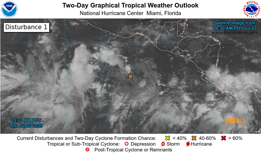
We have a tropical wave behind it and a bunch of disorganized showers and thunderstorms located a few hundred miles South of Mexico. It will probably form into a tropical depression by next week.
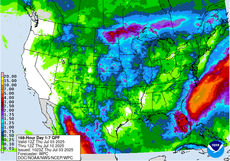
The most likely zones for heavy rain from the remnants of that front and any (sub)tropical low that can form from it will be over the Florida Peninsula and over the Atlantic, also the Mid-Atlantic coast. Around here our rainfall totals will probably average less than a quarter of an inch over the next week.